Page History
...
GERS is a Global Entity Referencing System that assigns stable, long‑lived identifiers to real‑world transportation entities such as road segments. It enables consistent matching and integration of geospatial data across different digital maps and versions, reduces fragmentation caused by map updates, and supports interoperable data layering across systems and providers.
GERS is developed and governed within the Overture Maps Foundation, where it is used to provide stable entity identifiers for Overture’s open transportation datasets. At the same time, GERS is designed to be map‑agnostic and reusable beyond Overture: the identifiers can be associated with equivalent entities in other digital maps, allowing datasets referenced via GERS to be exchanged, compared, or integrated across different map ecosystems.
Why the need for a stable global entity reference system?
...
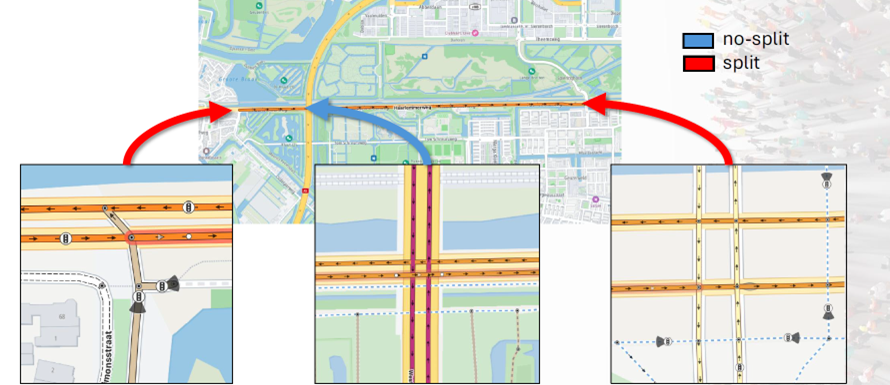
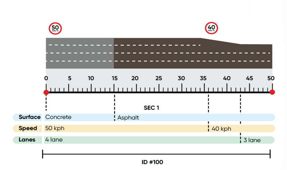
TBD: Explain picture above and below
Tools and Ecosystem Support
...
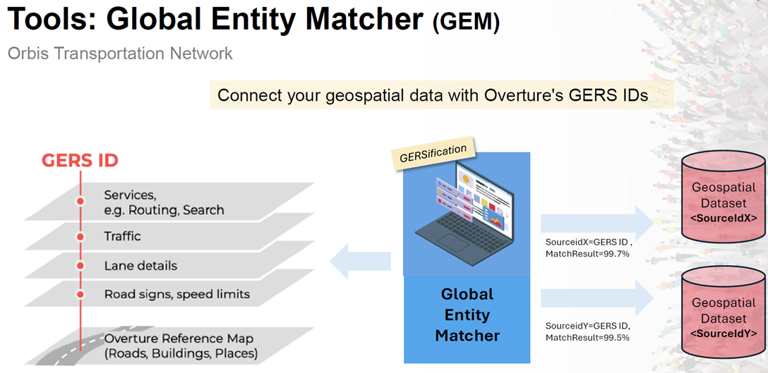
These tools allow both public and private datasets to participate in a shared reference framework.
GERSification process
Below figure explains the "GERSification process using the TomTom Global Entity Matching process
Explanation TBD
Use Cases
- Traffic and Incident Management: Persistent association of events with road entities across map updates
- Infrastructure Analytics: Long‑term tracking of road attributes and performance
- Data Integration Platforms: Combining datasets from multiple sources without repeated conflation
- Standards and Reference Architectures: Providing a practical model for stable referencing concepts
...
- Map Dependency: GERS is map‑agnostic but requires digital map data to construct and maintain entity definitions.
- Segmentation Rules: Decision‑point‑based segmentation is critical for stability.
- Attribute Modeling: Best results are achieved when attribute changes use linear referencing rather than geometry splitting.
- Governance: Long‑term stability depends on consistent application of modeling rules.
Decision Guide
| RequirementSuitability | GERS suitability | Notes |
|---|---|---|
| Long‑term stable entity identifiers | Excellent | TBD |
| Cross‑map data interoperability | Excellent | |
| Reduction of re‑conflation effort | Excellent | |
| Real‑time message encoding | Not the primary purpose | |
| Compact transmission format | Not applicable |
...
- GERS complements, rather than replaces, dynamic location referencing methods such as OpenLR.
- GERS is best used as a foundational reference layer for storing and integrating geospatial data.
- External datasets should be matched to GERS IDs using dedicated matching tools.
- Attribute changes should be modeled using linear referencing where possible.
References & Tools
For understanding GERS as a method, the following references are useful:
GERS - Global Entity Reference System | Overture Maps - Overture Maps Foundation
– GERS documentation- TomTom Global Entity Matcher (GEM)
- GERS Tutorial | Overture Maps Documentation
- Using the GERS "system" | Overture Maps Documentation
Comments
| 1 | |||
| 2 | |||
| 3 |
